

Price
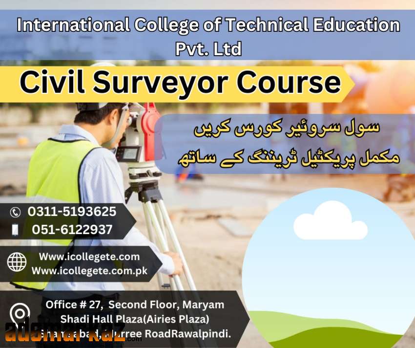
Rs 123Civil Surveyor course 3 months course available 1 month theoratical class and next 2 months course practical training will be given in field.For more information contact us: 03115193625.
Best Civil Surveyor (3 Months) Course In Faisalabad Punjab
Best Civil Surveyor (3 Months) Course In Faisalabad Punjab
A Civil Surveyor course is a thorough education program created to provide students with the abilities and information they need to work as professionals in the land surveying industry. This course is perfect for anybody who wants to further their skills and knowledge in the subject of land surveying or who wants to
pursue a career in the construction or civil engineering sectors. A wide range of topics, including surveying methods, measurements, mapping, and geospatial data processing, are covered in the curriculum. Students will gain knowledge of several surveying tools, including total stations, GPS receivers, and laser
scanners, as well as how to utilize them to precisely measure and map topographic features.
Admission open in Best Civil Surveyor course,Professional Civil Surveyor course in
Lahore,Attock,Taxila,Murree,Multan,Rawalpindi,Shamsabad,Islamabad Pakistan.
KNOWLEDGE PROFICIENCY DETAILS
On successful completion of this course, the trainee should be able to: -
1. Explain the objectives of survey and work of a surveyor.
2. Explain the principles, Classification and primary Division of Survey.
3. Define the source of errors and checking technique of surveying
instruments.
4. Define the temporary adjustment technique of instruments.
5. Describe the measurements (Linear & Angular)
6. Express the chain Surveying
7. Express the tackling of problems in Various Surveying Techniques.
8. Explain the use of all small/handy surveying instruments.
9. Explain the compass survey.
10. Define the solution of problems in compass survey.
11. Define the plane table survey.
12. Describe the leveling and leveling terms
13. Describe the leveling Instruments.
14. Describe the temporary adjustment of level.
15. Describe the principles of leveling
16. Explain the reduction of levels.
17. Explain the classification of leveling.
18. Explain the computation of earthwork.
19. Contouring.
20. Define the theodolite survey by traversing and triangulation.
21. Express the designing and setting out of simple/circular, transition
composes and vertical curves.
22. Express the horizontal and vertical and slop distance by tachometer.
23. Describe the equipment and procedure Photogramatery.
24. Define the total station, background and its uses.
25. Define the operations of total station and booking the fields notes.
26. Define the nature of Instrumental errors.
27. Explain the oral and writing improvement in communication skill.
https://icollegete.com.pk/civil-surveyor-in-rawalpindi/
https://icollegete.com.pk/civil-surveyor-islamabad/
http://www.icollegete.com/civil-surveyor-in-rawalpindi/
Best Civil Surveyor (3 Months) Course In Faisalabad Punjab
Best Civil Surveyor (3 Months) Course In Faisalabad Punjab

Best Civil Surveyor (3 Months) Course In Faisalabad Punjab
Faisalabad, Punjab
11 Apr